
The Solar Energy Industries Association (SEIA) launched an interactive land use map showing solar's footprint relative to other major land uses across every U.S. state. The tool arrives during Farm Bill negotiations in Congress, where solar development on agricultural land has become a focal point for critics arguing that panels compete with food production for limited farmland.
The map's central finding is straightforward: solar currently occupies 0.04% of total U.S. land area and 0.07% of U.S. farmland. There is no state where solar accounts for more than 0.5% of prime farmland. For comparison, suburban development since 2014 alone has converted roughly six times more prime farmland than solar has in total. Golf courses use 2.6x as much prime farmland as solar. Nationally, there are 43 acres of abandoned prime farmland for every acre of solar on prime farmland.
Why SEIA Is Making This Argument Now
The timing is deliberate. Farm Bill negotiations have drawn in voices skeptical of solar's expanding presence in rural areas, and several states have introduced or passed legislation restricting solar siting on agricultural land. SEIA's map is a direct response to that legislative pressure, providing state-level data that local officials, landowners, and developers can reference in permitting and zoning conversations.
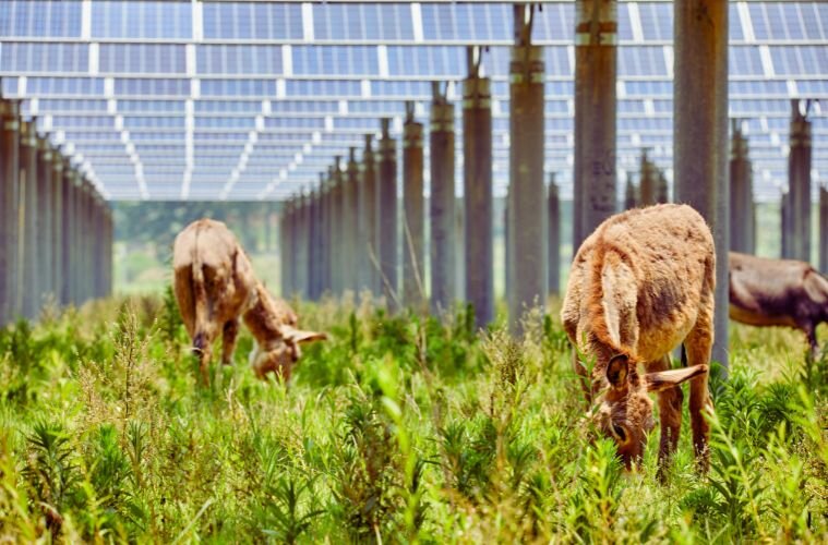
The broader industry argument is that solar and agriculture are not inherently in conflict. Many solar installations support what the industry calls dual-use or agrivoltaic practices, where panels are combined with grazing, pollinator habitat, or shade crops beneath and between arrays. Unlike low-density suburban development or recreational land conversion, solar projects can be decommissioned at the end of their operating life, returning land to agricultural use. That reversibility is part of SEIA's case that solar represents a different category of land use pressure than permanent development.
What This Means for Companies Sourcing or Siting Solar
For procurement teams working through power purchase agreements (PPAs) or on-site solar projects, the land use debate has practical consequences. Zoning restrictions on agricultural land can delay or block projects that were viable at the contracting stage, and the state-by-state variation in those restrictions has grown considerably over the past two years. A project sited on land classified as prime farmland in a state with new agricultural protection legislation may face a different approval pathway than the original feasibility analysis assumed.
The SEIA map provides useful context for early-stage site assessments, though it reflects national and state-level aggregates rather than parcel-specific conditions. For organizations with solar procurement activity in rural markets, it is a reference point for understanding where the political and regulatory environment around farmland siting is most active, not a substitute for project-level due diligence.


